


harvey
-
Posts
10 -
Joined
-
Last visited
Content Type
Profiles
Gallery
Downloads
Events
Forums
Articles
Posts posted by harvey
-
-
42 minutes ago, WrinkleysRule said:
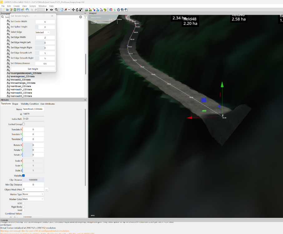
An image of your terrain height panel with your settings would be helpful.
-
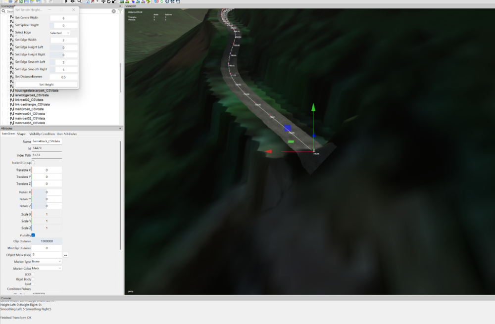
hey, smoothing edges on spline height doesn't work at all,
-
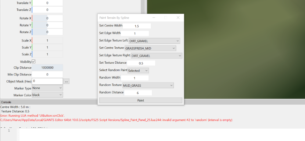
hey, got an issue with terrain painting script, when Random texture is selected it throws this error.
update: also effects the foliage script
-
How can i move it up elevation to match 10?
-
Hey guys
Having a issue working out my heights on this dem as im trying to use your maths layout wrinkley to do my distance mesh but as I have a - included i'm not sure where or how to calculate it, here is the details i have from qgis, is this going to need any editing or?

-
Hi again
thank you so much for that got it done quickly and easily, i learn more complex stuff from you than all of my teachers and you make it so easy.
im now stuck on my borders not lining up, i have uploaded a zip to google drive, it includes the tiff, the refrence lines for google maps, a blender file (3.6) and dems for the border with the cover textures. My dem is a 12km terrain squeezed into a think an 8x as my plane doesn’t line up as 16344 or 8192 scale
https://drive.google.com/file/d/1xGHILKeVGOTzGvmywCtdBNFsqdctoEYk/view?usp=drivesdk
Could you please guide me as to where im going wrong
thanks
MARVVV
-
Hey guys,
im redoing my dem trying to use the British LiDAR information, as it’s a 16x map I’m kinda brain hurt as not only have I got 26 different tiffs, I have below sea level areas down to like -10 and areas upwards of 315m (google earth) on some of the outside borders, I’ve been trying my best going over and over to no brake through, obviously I was hoping I could just import the tifs into google earth (which I have). and just copy that layout into a dem but for obvious reasons it’s too hilly (Mendip hills to Somerset levels) if you could point me in the right direction I would be grateful as going in circles for 20 hours isn’t the best
thanks
MARVVV
-
Hi,
just wondering if there’s any way to reverse a spline after using spline offset script as i need 2 directional traffic,
thanks, marvvv
-
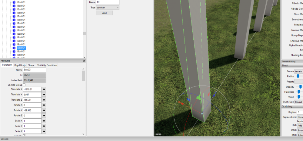
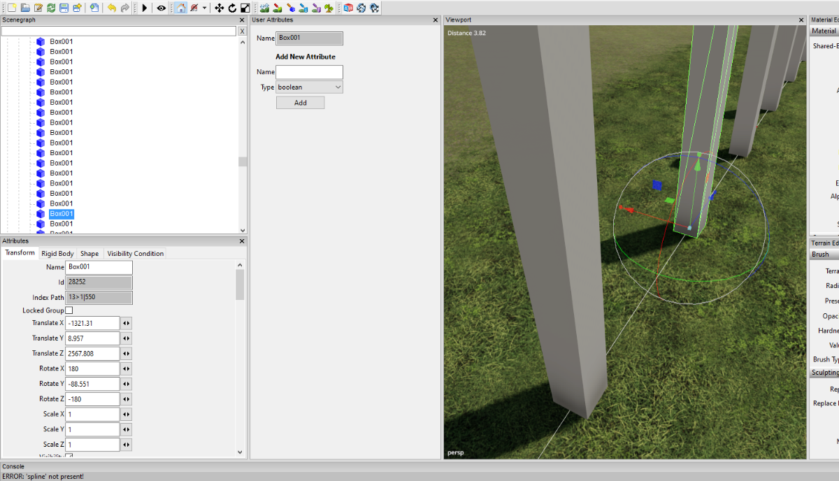
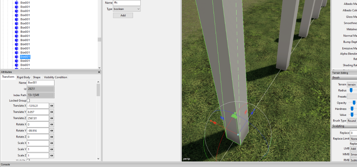
Hi,
dont know if this is the place to ask but looking for any suggestions, when using place by spline for some reason once a object hits a 90 on the y axis it turns to 180 -~ 180 or -90 on y would be something like that, is there a way to keep rotations in a format of 0 [number like 158] 0?
any helps greatly appriciated as am having blur troubles with blender method of creating roads
thanks, marvvv


FS 25 Updated Scripts
in Mapping
Posted
even with different height settings i still get sharp edges, couple other people have the same issue